Fuel Planning Over The Gulf

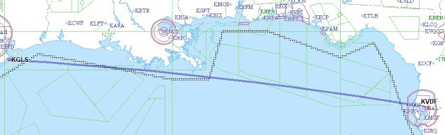
Last weekend was a perfect example of why you must “get good” at flight planning while enroute. I planned a simple direct flight over the gulf at 16000 FT from Tampa, FL to Galveston, TX. Conventional wisdom says you do your flight planning on the ground and then simply execute in the cockpit. It sounds […]
Fuel Planning Over The Gulf
Last weekend was a perfect example of why you must “get good” at flight planning while enroute. I planned a simple direct flight over the gulf at 16000 FT from Tampa, FL to Galveston, TX. Conventional wisdom says you do your flight planning on the ground and then simply execute in the cockpit. It sounds […]
Planning For A First Attempt At Skywriting
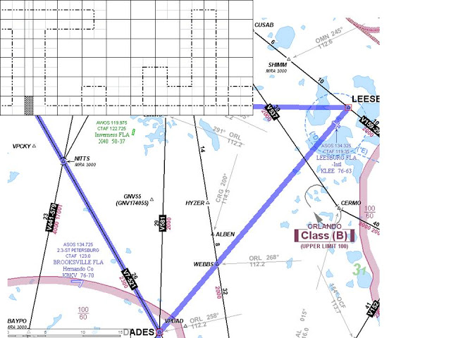
After reading several of Steve Dilullo’s posts, I feel inspired to try something a bit different this weekend. His post about ribbon cutting has quite cool. But I fly a Cirrus and I can’t “just open the window” to try ribbon cutting. However, his post about skywriting really got me thinking. I wanted to give […]
Planning The Next Big X-Country
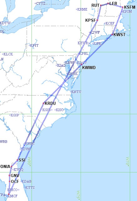
After getting serious about “My 50 State Quest”, I have come to realize how much planning is involved. The first 25 states just sort of happened as a byproduct of Work, Angel Flights, and General Joyrides. However, the next 25 states will require much more active planning. So here we are, near the end of […]