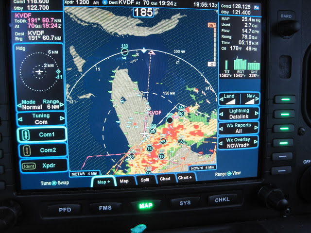
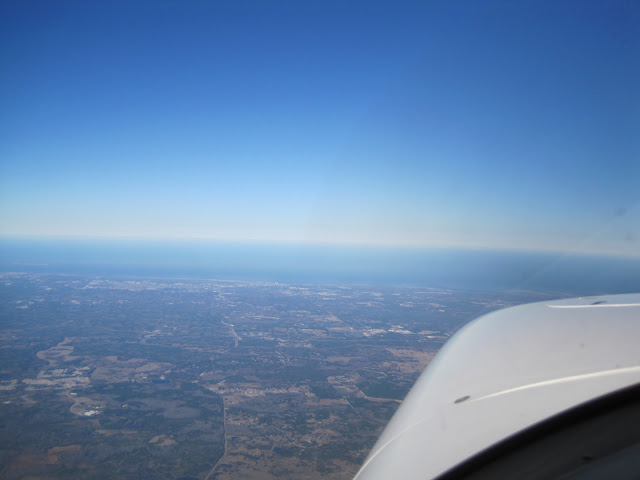
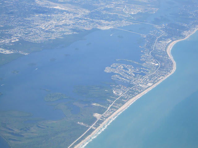
Shaking Off the Rust / Test Flight
Last week I returned from China and was planning to go a for a joyride with a fellow pilot named Ron, who was visiting town from Atlanta.
This flight was a multi-purpose mission:
First, and most important, I wanted to “shake off the rust” after 2 1/2 weeks of zero hours in the logbook.
Second, it is always fun to go for a joyride over Tampa Bay with a fellow pilot.  I was planning to fly over Clearwater Beach and shoot some approaches @ Sarasota and St Petersburg.
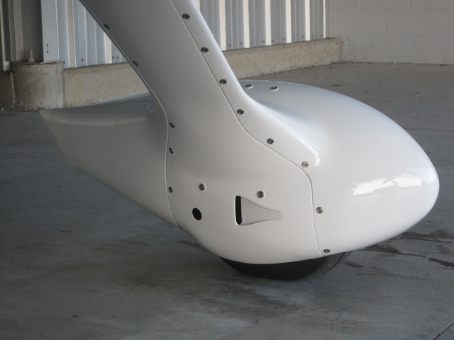
Third, I wanted to test out the new Lopresti “Ice-Skates”.
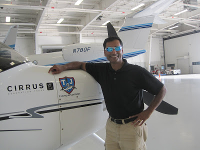
No … the “Ice-Skates” don’t let me land on ice… However, they allegedly add a “few” knots to your cruise speed and they also provide a cool little door that lets you get access to your tires.  This is such a simple modification, I have always been surprised that Cirrus didn’t make this a standard feature of all SR22s.  You can see the finished product (sans decals) below:

Ron and I got to the airport shortly after lunch.  I called from the car to have the line guys pull the plane out and have it ready right in front of the terminal.  (I know that sounds lazy… But I usually do this when I have passengers)  When we arrived, the first important task was to update the R9 charts/GPS.  While that was running,  I conducted the usual preflight.  Everything looked in order and we climbed in ready to go…
Unfortunately, “Murphy” had other ideas!  The plane simply would not start!!
Ugg… The only good thing was that I was at home base and Jonathan from Leading Edge was able to come over and quickly diagnose that I had a bad Mag 🙁
So my test flight was delayed for a couple of days… 🙁
A few days later, I finally got to take the test flight.  This time I was alone and being even more cautious than usual.  On the ground, I did 2 full mag checks and everything checked out perfectly.  Then after a simple take off, I climbed north of Zephyr Hills and leveled off @ 3500 FT.  Winds were 210@22 and I decided to do an in-flight mag check, which also checked out fine!
Confident that the plane was in good working order, I decided to check out the Ice Skate performance.  I climbed up to ~ 11,500 FT and leveled off at a typical cruise configuration.  Usually, this would yield between 175 – 180 knots.  However, the winds were now 240 @ 34.  Given the winds, I couldn’t figure out if the Ice Skates really helped or not.  So I guess that will need to be another test flight on a calm wind day.
With all tests complete, it was time to practice a little… I did a couple of 360s, slow flight and then did a couple of GPS approaches into Lakeland.  This time I wanted to play with the GPS features of the Contour camera and I think I have finally figured it out!  Haven’t had to time to edit the video yet… But hopefully in the next couple of days.

Cheers,
== T.J.==

Migration 9 Trip Summary

I have finally arrived in Colorado Springs and the journey was quite amazing!

It is hard to summarize a 4200 mile trip.   (But here goes…)

Some of it what was “as expected ” ; Some of it reinforced how flexible you need to be on a journey like this. Between weather, customs formalities, spotty radar, icing, even the exact route was not as planned.  You can see the “planned vs actual” route below:

The blue line was the planned route.  The magenta line was the actual route.  As you can see, I tried to follow my plan.  But needed to make lots of adjustments along the way.
 
On my first leg from Tampa to Hopkinsville, KY, the weather in the picture below forced me to do an enroute diversion to Shelbyville,TN:

I landed and topped off minutes before it started pouring!

After the storm passed, I continued to Sioux Falls, SD where I did my first overnight.
The next day started mostly as planned Sioux Falls,SD > Bismarck, ND > Glasgow, MT.

As I made my final Preparations to enter Canadian airspace, the Canadian authorities (Canpass) informed me that the Kamloops customs was “Closed for the day” So I had to pick an alternate destination and chose Kelowna, British Columbia.

With a new destination, I entered Canadian airspace for the first time to find more surprises. While crossing the Rockies, Edmonton ATC informed me that radar coverage would be “lost over the Rockies”, which was not very comforting!  They gave me a frequency and told me to “try calling Vancouver” in ~ 30-45 minutes.

 
Luckily, the weather was good and of course the view over the Rockies was breathtaking.
(I am still trying to sort through the pix to make a Picassa album.)
 
Kelowna turned out to be a wonderful destination.  The  airport is rather  unique due to the terrain.  It is in a valley, which causes you to fly an unusual approach with a fairly steep descent. (Still working on editing that video)
The next day I flew to Ketchikan, Alaska, which was a very challenging flight.   Canadian ATC instructions/phraseology is just a little different than the US.  But I managed several surprise instructions and even a last minute approach change and had an incredible landing, which is shown in the video below:

After that landing (and enjoying Alaskan hospitality and seafood), I thought that Ketchikan would be the highlight of the journey.  But after a couple of more states, the real highlight of the trip materialized in Leadville, CO.  Lake County Airport in Leadville, CO is the highest airport in North America @ 9927 MSL.  I landed there on a precision approach with a “circle to land” into an 18 KT headwind Gusting to 28 KTs, (Perhaps NOTmy most elegant landing… But certainly  one of the most difficult and satisfying landings I had done in a long time.  
 
As you can see from the pic below, they really do issue certificates for landing there!!

After Leadville, a short 20 minute flight to Colorado Springs and I was warmly greeted by the staff of Colorado Jet Center.  So after this incredible journey, I am now ready for the main event (Migration 9), which is scheduled to start tomorrow morning.
 
Cheers,
== T.J.==

White Plains and NYC Skyline

I spent this week in NY, specifically in White Plains, which is just on the northern edge of the New York Class B airspace frenzy.  But more importantly, it is also the home of IBM Flight Operations.  The IBM fleet consists of a number of aircraft, including Gulfstream 550s, Falcon 200s and even helicopters.  As you can imagine, they have an enormous hanger to house this little fleet.
As you can see above, I was lucky in enough to arrange a tiny corner of the hanger to call home for the week.  In the photo below, you can see me with the CEO’s G550 in the background. 

Actually, the G550 is such an enormous and impressive plane, that my Cirrus could have fit under the wing.

Even more than the aircraft, the IBM Flight Operations staff are really impressive!  They have several dozen staff on the crew and they run a “mini airline” with everything from full maintenance, avionics work, to catering, planning, dispatch etc.  The entire crew showed me some incredible hospitality this week, which I truly appreciate!

The night before my trip home, I wanted to do a “fly-by” of the NYC skyline along the Hudson River.  I had read about this scenic route in numerous magazines and was eager to experience it firsthand.  There is an FAA procedure that has been established for this route that is very simple to follow.

Even though the procedure is not complicated, I went with a friend (Steve), who is a local pilot.  This gave me a safety pilot on board.  In addition, it gave me an extra set of eyes for traffic and another photographer on board.
If you have the opportunity to try the Hudson Corridor, I highly recommend it… The camera simply doesn’t do it justice!Cheers,

== T.J.==

Long X-Country, Weather and State #38 (AZ)
This weekend I had a long cross country flight planned.  The destination was Sedona, AZ, which is a very famous airport for pilots. 

According to the Sedona Airport website, they claim to be “America’s Most Scenic Airport”.  It is also sometimes referred to as the “USS Sedona” because it feels like landing on an aircraft carrier.  This is due to the fact that the airport is situated on a Mesa with a 500 FT dropoff on both ends of the runway. 

To add further drama, Sedona is home to a number of “spiritual vortexes”, which are clearly identified on tourist maps.  In fact, one of them is right on the Airport access road.  Some say that it may even contribute to the bizarre wind patterns that pilots wrestle with on final.
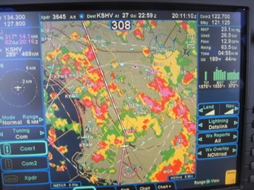
The first leg from Tampa to Shreveport was a grueling battle with weather.  You can see from the screen shot below why I had diversion clearances of 20 degrees right or left most of the way.

Luckily after Shreveport, there was no more rain to contend with.  The next stop was supposed to be Truth or Consequences, NM.  I thought the name was unique, and their runway layout even more unique.  But as I was flying over West Texas, I needed a break.  So I pulled out the iPad and found a great little airport in Snyder, TX that was only 40 miles from my position and had cheap fuel, internet and a crew car!

Since I was on an IFR flight plan, I called ATC and told (not asked) to divert to Winston airport (KSNK).  Their immediate response was “WHY???”.  I replied “NO emergency… Just change in plans”.  Then I did a couple of 360s to get down from 16,000 FT and had an uneventful landing.  The crew at KSNK (Ray and Danny) were extremely friendly and helpful.  After a bite and a bunch of “hanger flying” with the crew, I was ready for departure. 

However, it was 95 degrees out and I struggled with the hot start.  After 2 failed attempts, I pulled up Alex Wolf’s YouTube video on SR22 hot starts and that did the trick. (Thanks Alex!!)

Now I was finally direct Sedona.  As I approached, I instantly understood why this airport has so much hype. The views were breathtaking!  I tried to capture some of it on video, which you can see below:


So Arizona is now officially state # 38 and because of my little detour, I will try to hit New Mexico on the way home.

Cheers,
== T.J.==

Scenic Trip to Cedar Key

This morning I woke up and  looked outside to find typical weather for FL.  Sunshine as far you could see ; Clear blue sky ; AND a perfect day to go flying!  After my recent CPPP training, I have been sufficiently brainwashed into treating every flight as an opportunity to practice something.

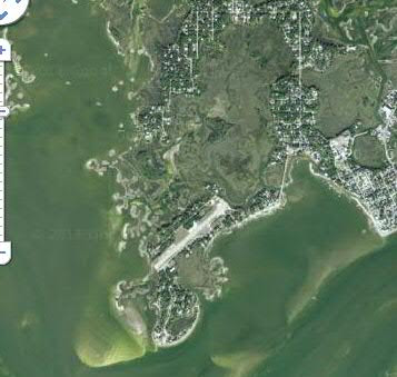
So this morning, I decided to practice short field landings @ Cedar Key Airport, which is a small island airport just west of Ocala.  For a civilian pilot like me, who will likely never get to land on an aircraft carrier, this is as close as I will get.  As you can see in the Google map below, the sole runway  5/23 has water on both ends!

In addition to having a 2300 FT runway, which is short 4 me, they also have NO instrument approaches!  As many of you know, my comfort zone is IFR in Class B airport environments.  So going to Cedar Key was perfect for today!  This gave me a scenic place to fly and gave me some practice outside of my normal comfort zone.

After an uneventful preflight, I departed VFR @ ~ 9AM.  With the music on, I stayed under Tampa’s class B airspace and flew westbound first till I got to the coast.  Then, miraculously without GPS,  I followed the coastline northbound and didn’t get lost!  During the entire journey, I didn’t even talk to ATC!!  

Before attempting Cedar Key, I wanted to practice a landing first on a longer runway.  So I did a “stop and go” @ Crystal River Airport.  The runway there was about double the length of Cedar Key.  Since I handled that with no problem, I felt ready for Cedar Key.

I easily found Cedar Key Airport but felt almost distracted as I approached for landing.  I was trying to concentrate on airspeed and attitude, while I kept getting distracted by sights out the window.  But other than the distractions, the landing was quite easy with calm winds and no surprises. You can see the landing for yourself in the video below:

After I landed and found a place to park, I realized how small the place was.  There is no fuel, no services and only about half a dozen parking spots on the tarmac and a another half dozen in the grass.  I didn’t even see an FBO terminal.  Instead of an FBO, I was greeted on the radio when I was about 5 miles out by a very friendly cab driver/ tour guide named Judy.  She drove her car right up the taxiway and picked me up next to my plane.  

She showed me around the island a bit, which only takes a few minutes because it is so small.  Then suggested a quaint little place for brunch.  After a quick bite, I took off again and circled around the island to get some more pictures before going home.

Cheers,
== T.J.==

Bahamas Practice Flight

My international radio license arrived yesterday in the mail. Earlier in the week, I saw online that it had been approved. But didn’t get the official paper in the mail till yesterday.
That meant that today was the day for the long overdue Bahamas flight!!
It was really perfect timing because the plane is going down for a “good type of maintenance” tomorrow. (Will tell you more about that in a separate post later this week.)
Back to today’s plans…
Before doing this flight with family or friends, I wanted to try it solo first.  So the plan was simply to fly there, maybe grab a bite, and fly back.  Not a terribly interesting trip… I just wanted to practice the legal/aviation parts without alarming or inconveniencing any passengers.  Once I felt comfortable doing this type of flight (without getting arrested, fined or meeting F-16s enroute), then I would be ready to do it again with passengers.
While I could have easily flown direct from Tampa Executive (KVDF) to Grand Bahama (MYGF), I chose not to.  Instead, I decided to stop @ Fort Peirce (KFPR) to make sure I had everything in order (paperwork, fuel, lifejacket,etc). On the return trip, I would have had to stop somewhere for customs clearance anyway, and I have heard through the grapevine that the FBO and customs office in KFPR is excellent.  So I thought it would be a good idea to stop there and check out whatever local procedures they may have.
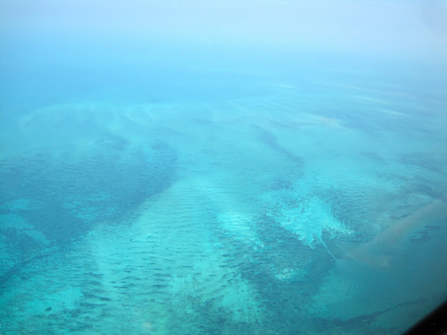
In hindsight, it was totally not needed!  After I landed in Ft Peirce, the staff at the FBO confirmed that I indeed had everything in order.  After a top off and a rather easy “hot start”, I took off and pointed the nose straight to the water.  After climbing to 7000 FT, the next ~ 100 miles was directly over water and the view was consistently like this:
This was the first time I was over water for this long.  As you can see, I had my lifejacket handy (just in case)

Thankfully, I didn’t even need to open the packaging.
After about 80 miles over the water, I finally caught my first glimpse of land and it was spectacular:

As I got closer to Freeport, Bahamas, the Bahamas ATC controllers cleared me for the VOR DME 24 procedure!  This took me quite by surprise.  Other than initial instrument training, I had NOT flown a real DME arc in a VERY long time.
I keyed it into the R9, which happily complied, and I saw the following screen:

The screen looked odd to me and I felt like I was operating slightly out of my comfort zone.  I flew halfway through the 12 DME Arc at 4000 FT.  Then the ATC controller broke off my approach and cleared me to land with an “expedited” descent.  I am not sure why… But suddenly, he seemed to be in a hurry.  I did my best to comply and did a 1000 FT/min descent and fought a 15 KT crosswind on final.  When I was finally on the ground, I breathed a sigh of relief and really felt like I “earned” that landing!
I wasn’t sure what kind of ground operations to expect.  At this point, I must admit, I was a little nervous.  But it turned out to be quick and painless.  One of the line crew marshaled me into a parking spot and I was immediately greeted at the plane. They escorted me to a small building where they checked my passport and my paperwork.  The whole process took no more than 5 minutes!!  I was so impressed at how professional and efficient they were.
With similar ease, I filed my flight plan for the return trip and waited an hour to depart as required.  I landed back at Ft Peirce and cleared customs, which was totally painless and also took less than 5 minutes!
Overall, it was so easy, I really didn’t need a practice run.  But now I am even more excited to go back there with passengers and stay for awhile!!
Cheers,
== T.J.==

Photo Opps And Dodging Airspace

Today was one of those traditional $100 hamburger days. An IBM colleague of mine (Richard) was visiting from Spain. He has heard me rave about flying for years and I thought today was the perfect day to show him firsthand.
The plan was either to fly to Key West or Palm Beach, both of which are gr8 $100 Hamburger destinations. When Richard learned that Disney was right on the way to Palm Beach, the decision was clear. He had just bought a new camera and was eager to try it out en route over Disney. However, I warned him that there is a temporary flight restriction (TFR) over Disney, which may hamper the photo opportunities.
Interestingly, the Disney TFR is not so temporary. In fact, it seems to be a permanent restriction that prohibits all aircraft from surface to 3000 FT. (I guess Mickey doesn’t want anybody buzzing Cinderella’s Castle).
But I had a trick up my sleeve that I was hoping would result in a legal way to get into that TFR airspace.
When we were ready for takeoff at Tampa Executive there was a broken cloud layer @ ~ 5000 FT. We climbed through a nice big whole in the clouds @ ~ 1000 FT/min and enjoyed a smooth ride at 5500.

Now it was time to setup for my TFR trick. The Kissimmee Airport has an instrument approach procedure (RNAV GPS 15), which cuts right through Disney’s TFR!  As long you get the appropriate clearances from ATC, you can get low enough to get some gr8 views of Magic Kingdom, Epcot and Downtown Disney.  We got cleared down to 2300 FT, which was comfortably below the clouds and enabled Richard to put his new camera to the test.
After our Disney flyby, we went missed approach on the procedure and continued direct to Flagler County Airport , where we had lunch @ Hijackers.  On the way back, we had more airspace to deal with.  The restricted area just north of Orlando was active and the Orlando approach frequency was too busy for us to pick up flight following or even a clearance into class B.  As a result, we climbed through another  “whole in the clouds” to get on top of the class B @ 10,500 FT.  After clearing the Orlando airspace, we needed to descend and fortunately found another nice big whole in the clouds.  In order to maintain VFR, we needed to do some steep turns and 360s to make it through the whole.
Then moments later, we actually saw a skydiver near Zephyr Hills under a bright red canopy!
So in the end, Richard still needs a lot of practice with his new camera.  But as you can see, overall mission accomplished for today!
Cheers,
== T.J.==

Heading Home VFR

Today the weather in Houston was not bad… But the weather forecast along my route home and in FL was downright ugly.
Fortunately, PIREPS showed a lot of the weather did not have very high tops along my route.  So my plan was to depart VFR, climb up to 17.5k and if needed get an IFR clearance for the descent or along the way.  In addition, I knew the route quite well, including several possible fuel stops if things didn’t look good.  Shortly after takeoff, I climbed to 17.5k as planned.  Then benefited from a very strong tailwind that was even better than forecast.  Thanks to some miserly fuel consumption, I made it all the way to Ocala!  Since there was a solid cloud deck below me, there was not many photo opportunities.  However, the descent was rather interesting.
I wanted to try to maintain VFR, which involved doing a rapid descent (full forward slip) right through a good sized “hole in the clouds”.  After descending to 3500 FT, Jax Center cleared me for the GPS 18 approach.  The ATIS claimed winds “170@11Gusting18”.  I thought to myself “that was pretty good… Should be an EZ landing”.  When I was on final approach, the tower controller called out a wind check of “170@18Gusting24”.  I thought “hmmm… little worse… But no need to abort”… Then I checked my R9 screen when I was on 1 mile final and it read “175 @ 30”!  Clearly this was the strongest headwind I had ever faced on a landing.  I considered aborting the landing…  But I was on minimum fuel and the plane “felt” stable and under control.  So I proceeded in what felt like slow motion.  Even with 19″ inches of manifold pressure, my ground speed was hovering ~ 70 kts.  I landed right on the numbers and felt like I barely used half of the runway.  In fact, I had to add power on the ground just to get up to the E6 taxiway.
I had purposely picked Ocala as a stopping point because it was a good excuse to catch up with Jason Schappert of MZeroA.  I was hoping to grab a quick meal and squeeze in a “brainstorming session”, as often happens when Jason and I start talking.  But I got a pleasant surprise today… I got to meet his charming, new bride Ashley! (Now I have even more reason to stop in Ocala!!)
Onto the final leg home.  The weather was deteriorating and luckily I was able to get out of Ocala ahead of the cold front.

The winds had not provided any mercy… I had 30kt headwind from 170.  This meant that I should land on the “short” 3200′ runway 18 at Tampa Executive.  This was entirely unusual for me.  I am much more accustomed to landing at big airports with 5,6 or even 10000 FT runways. Tampa Executive airport has 2 runways.  Runway 5-23 is a 5000 FT runway, which I use 95% of the time and runway 18-36 is a 3200 FT runway.  Given the choice of a massive X-wind on the long runway or a strong headwind on the short runway, I chose the “short” 3200 FT runway 18.
The landing was uneventful… But I am glad I arrived when I did… Because after landing, putting the plane in the hanger, and returning some calls, this is what I saw on the drive home:

Just goes to show, timing and weather are way more important than any flight planning!
Cheers,
== T.J.==

Trip To TX

The trip to Houston this past Sunday happened “almost” as planned.  On the one hand, it reaffirmed my flight planning/route selection process.  But on the other hand, it reinforced the need for flexible plans enroute.   when I was getting ready to depart, I thought the weather was “perfect”.  Shortly after takeoff the visibility (and views) were great:
While there was not a cloud in the sky, something just didn’t feel right…  After reaching a cruising altitude of 16k, I noticed what it was.  There was a nasty 50+ knot headwind.  See what I mean:
Despite a true airspeed of 186 @ 75% power, my groundspeed was hovering ~ 140 knots!  At this rate, the 2hr planned leg would surely be much longer.  But what can you do?  “Nothing!” I concluded other than “Plan B”, which is just find some good music and relax…  Unfortunately, the satellite radio had its own plans.  After about 10 mins of flipping channels and not finding anything, I resorted to Plan C: Iphone4 plugged into Aux input of the Zulu headset:
It was at this point, I discovered a really cool feature of the Zulus… When ATC speaks on the frequency, the Zulus do NOT mute the music.  Instead, it reduces the volume by 80%.  This may not sound all that significant.  But I found it to be such much more pleasant than the typical hard mute!  After a much longer than planned flight, I landed in Bay Minette, AL for lunch and a break and then went on to Houston.  Thankfully, the headwinds were  quite tame for the 2nd leg!  But since I was running, I ended up skipping Galveston.  Maybe I will stop there on the way home…  (Even better maybe I can ride a massive tailwind home!)

Cheers,
== T.J.==

Sunrise Flight to Miami

While I am not a huge fan of night flying, I do love departing in the dark and being airborne for sunrise.  The ride is usually smooth, clear and best of all, so “empty” that ATC will usually grant any “crazy” routing I come up with.
Today was no exception.  After an uneventful pre-flight (in the dark with a flashlight), I departed my home base @ Tampa Executive Airport (KVDF) and flew mostly direct to Opa-Locka Executive Airport (KOPF).  (Yeah I know it is a funny name for an airport… But this airport is just 8 miles away from Miami International and MUCH easier to get in and out for a little plane like mine.)
When flying alone, I typically fly most flights IFR @ 16k or 17k.  But today just felt like a VFR,  “no oxygen” day.  So after reaching my cruising altitude of 9,500, I witnessed an amazing sunrise! Unfortunately, I don’t have a good enough camera to capture it.  (Or maybe I am not a good enough photographer to capture it)… But here is my attempt:

The picture doesn’t do it justice!  I tried a dozen times to get a good picture without much success.
Between the view and the music on the sat radio, I really didn’t want the flight to end.  But before I knew it, I was getting close and had to begin my descent.  By that time (~ 7AM), the Miami airspace is starting to get busy and I had to really concentrate on the rapid fire heading/altitude changes from ATC.  I was so proud of myself for two reasons.  First, I “nailed” every instruction just right.  Second (and more satisfying), I was the only “little GA” airplane on the frequency.  Every other aircraft on the frequency was some airline or another.
So after a simple, visual landing, I followed the line guy to a parking spot and “went to work”.  After a full day of back to back meetings, it was time to go home.  I decided to take a slightly scenic route and flew up the east coast of FL to Ft Peirce, then Vero Beach before turning west.  The weather was beautiful and the sights were downright artistic.  Here are couple of shots along the way home:

Ft Pierce (along the coast) just north of Miami

Aside from the view, one of the great things about flying on the east coast of FL is that the air traffic controllers are “world class”.  After Vero Beach I was planning to dodge and weave around the military airspace in the middle of the state, when a VERY friendly ATC controller helped me out.  Here is the scenario:

The photo above was my planned route of flight.  The Blue lines represent the edge of Orlando Class B airspace.  The thin red lines are a military restricted airspace and the thin yellow lines are a military operations area (MOA).
Then a Miami Center controller noticed what I was doing and offered a direct clearance through a restricted area.  I quickly thanked him and accepted the clearance.  Here is what my amended route looked like:

While the amended route only shaved a couple of minutes off of my trip, I was more impressed than appreciative.  This controller was already handling 6 planes (that I heard on the frequency), THEN anticipated what I was doing, and THEN proactively tried to help.  That type of behavior just reinforces my belief in how well trained and professional these ATC controllers are!
Last picture I wanted to share from this trip was near Lakeland:

Now you see why it is called Lakeland 🙂

Cheers,
== T.J.==